二格山O型-遠跳海平線

天南宮登山口
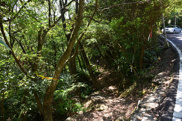

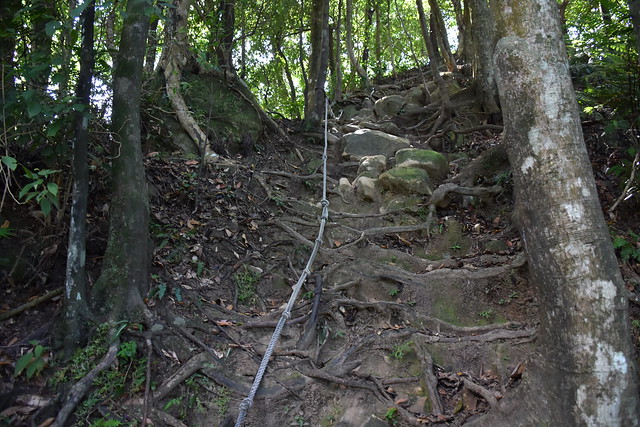
由此進入步道沿途都在是在樹林內完全曬不到太陽。剛開始的路況為緩上,後半段變成多處需攀繩而上的路況。如果習慣走這種攀繩而上的路況,應該不會花太久時間就可以抵達筆架連峰岔路的產業道路。後來爬文才知道此處就是綠豆湯鞍部。

視野一級棒的二格山
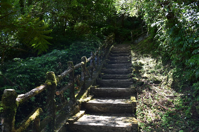
循產業道路前行約100公尺抵達二格山第三登山口。站在登山口迎面而來的陡上的水泥階梯…這段階梯不但陡、每階梯的高低落差又大,走來令人容易感到疲累、不時需要停下來休息。對我來說比剛剛那種攀繩陡上還難走

踏完這人工水泥階梯抵達稜線,稜線左右兩側都有一個觀景台。我們先往左到觀景台然後才去到二格山。左側觀景台的視野雖不好,但往前走幾十公尺的視野卻很棒。以前以為在台北市只有拇指山在好天氣時可以看到海平線,沒想到此處也可以。


當天天氣好、空氣乾淨,如此棒的視野加上觀景台又可遮陽。不經在兩個觀景台就待了一個小時~


對了,編號701號的二格山三等三角點位於觀景台旁邊,一個頹圮的水泥牆內。


草湳登山口
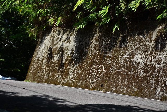
離開二格山我們往西走,經過南邦寮山(無視野)後往草湳方向下山。草湳岔路處的空地處放有三個令人覺得有點突兀的塑膠板凳,但看地圖的等高線後我就懂了…因為由此下去為陡下。事實上,這段也真的蠻陡的、另外也比剛剛路線都潮濕。


在經過一處駁坎後坡度就稍微變緩、登山口也不遠了。最後經草湳的產業道路走回深坑天南宮,這段也是今天唯一會曬到太陽的路段(其實兩旁還是有不少樹蔭)


路線/時間
單程約5公里。以下是我到各地點的時間、與各地點之間的距離。登山口(09:40) > 攀繩(09:52, 0.5K) > 草湳叉(10:07, 0.3K) > 產業道路(10:12, 0.1K) > 二格山第三登山口(10:21, 0.1K) > 觀景台(10:35, 0.2K) > 二格山(11:01, 0.2K) > 南邦寮山(11:48, 1.1K) > 叉路下山(12:00, 0.2K) > 駁坎(12:23, 0.3K) > 登山口(12:27, 0.1K) > 渤海草堂(12:38, 0.6K) > 終點(12:56, 1.1K)
完整照片
二格山O型完整照片二格山O型高度表
點下方高度表,可瀏覽較大的高度表圖檔
留言